| Sunday, October 29, 2006 |
17:36 - Dadblang it
|
(top)  |
Oh, Google Earth. How do I love thee? Let me count the ways.
... Five hundred thirty-three... five hundred thirty-four... five hundred th—
Aaargh!
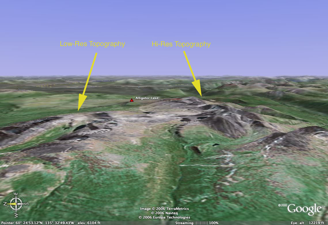
All the topographical data north of about 60°23'—just south of Whitehorse, Yukon—is severely low-resolution. This doesn't cause much of a problem over most of North America, where most of the landmass above that latitude is totally flat. But if what you're interested in is Alaska... well, it makes for some goofy-looking mountains, with shadowed crests and edges mapped onto these dull, rounded lumps in the ground.
You can't properly see Tombstone Mountain (north of Dawson City), or the Brooks Range, or the funky barren hills of the Top of the World Highway, or even Denali. The roads and rivers and placemarks are all there, but the shapes on the skyline are all muted and anticlimactic.
... Don't you hate it when some company puts out some amazing new piece of technology (Google Earth, Aperture, Spotlight, etc) that nobody had ever imagined was possible the week before—and then, days later, the blogs and message boards are full of people complaining about how this great new product is full of gaps in functionality and poorly implemented features? This in a technology that had been completely missing from their lives up until just a few days before?
Bah!
|
|
 Brian Tiemann