 | |
| day-04.gpx | Gogle Maps GPX Viewer |
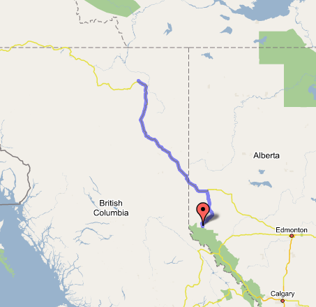
Grande Cache, AB to Fort Nelson, BC
We're on the Alaska Highway for real! Three full days left to make it from Fort Nelson to Fairbanks.
Left Grande Cache at around 8:00 AM, BC time, after not realizing we had to switch to Mountain for Alberta time; it seems to be for the best anyway. Had breakfast at a nice little family restaurant (hearty mountain-type fare), and afterwards tried getting a jacket at a thrift store when it opened, but couldn't figure out where the door was. The road north of Grande Cache was scenic and striking, far different from the first half of Highway 40 (the Bighorn Route). It cut through canyons in the Rockies foothills until they settled out into birch-clad prairies that went on without change for as far as the eye could see, and then we knew we were near Grande Prairie, a sizable small city (40,000 people) that reminded me very much of the Midwest. (Northern Alberta is a major breadbasket, I have to keep reminding myself, and well settled.) A short drive on a wide divided highway through spreading canola fields and elk ranches took us back into British Columbia and into Dawson Creek, where we got the requisite photos at the commemorative roundabout and signpost, and gassed up at a nearby Safeway. (Safeways with gas stations in their parking lots, where you get a discount with your club card, are apparently pretty common in Canada.) The attendant told us to "have a nice trip"; my oh my, how ever did she guess?
Got on the road at about 11:00, amid a light drizzle and unremarkable traffic. The Alaska Highway begins with civilized farmlands (mostly canola fields, recognizable as sheets of bright yellow), which gradually peter out; and by the time we reached the Peace River crossing at Taylor (and took photos at an overlook where the rain caught up to us again just as we stepped out of the car), settlements between towns were sparse, though not unheard-of. The highway/main street through Fort St. John was completely under construction and dusty/muddy. The Milepost kept us entertained looking for landmarks, as did Mom & Dad's old journals, which we read in sync with our encountering all the waypoints like Wonowon (at Mile 101—get it?), Buckinghorse, and Pink Mountain, where we made a pit stop at a hilltop restaurant and looked at the maps on the walls, most of which had been worn through with years of travelers' prodding at the route with greasy fingers. (You could just hear their unquiet shades going, "Here's where we are, right here," from the shadows.) After Sikanni Chief, a deeply cleft river canyon where the bridge was being worked on, there were fairly frequent potholes to watch out for in the otherwise good road surface; and after one particularly rutted mud hole that suddenly appeared in a 100 km/h zone, we saw a pickup truck that had just lost control and gone into the ditch. Several travelers had stopped to offer assistance. About a mile beyond, we saw a lone Mountie with a speeding victim—the only sign of law enforcement on the Highway so far. We also picked up a chip in the windshield near here, on the flats above the Prophet River valley. (Right in front of my face! Grr!) The landscape was pretty and lonely, usually consisting of mile after mile of scrubby spruce trees (much smaller than you'd expect to find further south) and rolling hills in broad valleys, with infrequent open grasslands (usually near rivers) and occasional rises into small passes from which you could see the road winding away into the distance.
After the Prophet River area, it was a long and unremarkable drive through frequent rain squalls until we got to the power generation plants and lumberyards south of Fort Nelson, where we'd planned to gas up and then press on to the Muncho Lake area. But an examination of the Milepost suggested that the only lodging opportunities in the mountains ahead would be expensive and full, so we recalculated the stopping points from here to Fairbanks and decided we could afford to stop at Fort Nelson for the night.
First we stopped in a combination motel/gas station to check into room availability; on a TV playing in the corner, we watched the news of the Air France plane that had crashed in Toronto—apparently, everyone survived. (I doubt the same can be said of their luggage.) With plenty of time to spare—it was only about 5:30—we priced several more motels (mostly around $75, except the $139 Super 8, which had four stories and looked brand-new but stood in a gravel and mud parking lot) before finding what we were looking for in the Fort Nelson Motor Hotel, an unassuming blocky building that housed a fabulous indoor pool area, a stunning and immaculate room with glass doors sliding open onto the pool atrium, and a funny and friendly receptionist (Chris by name—she kept joshing us about sundry topics and confiding tips like when the techno party would start in the attached bar later that night), all for about $55. And that's Canadian, mind you.
Since it was still early by our standards (about 6:00), we did a side jaunt to the Liard Highway, something I'd been hoping to do all along, because it led to the Northwest Territories and another opportunity to set foot in a remote region I might never see again. However, it was raining again, and the road was packed gravel... and the NWT border was over 75 miles away. So we drove up far enough (about 5 miles) to get a feel for it and some photos in lieu of actually visiting the Northwest Territories; somehow I don't feel too gypped. The country was pretty but not too alien—dense birch woods covering rolling hills extending into the gray distance northward. We turned around and admired the sights south and west over the low-lying Muskwa River flats toward the Rockies; then headed back to town and got a pizza, chatting up the local employees, who told us tales of what it's like to grow up and live so far from civilization, where their idea of the impossibly distant, southern "big city" was Edmonton. Took the pizza back and ate it in our gorgeous wood-trimmed room, wondering why the hotel was so empty of other guests, before watching a movie and turning in for what we hope is a great night (last night's was a little cold and noisy from passing truck traffic on the Bighorn Route). Tomorrow, we shoot for Whitehorse if we're lucky; Teslin otherwise. Chris told us sidelong—conspiratorially—that although Net access is billed hourly, we could just sit near the pool (or in our rooms) and get free wireless. Four bars, baby!